Veteran-Owned · FAA Part 107 · Commercially Insured · Rapid Response
850-803-7663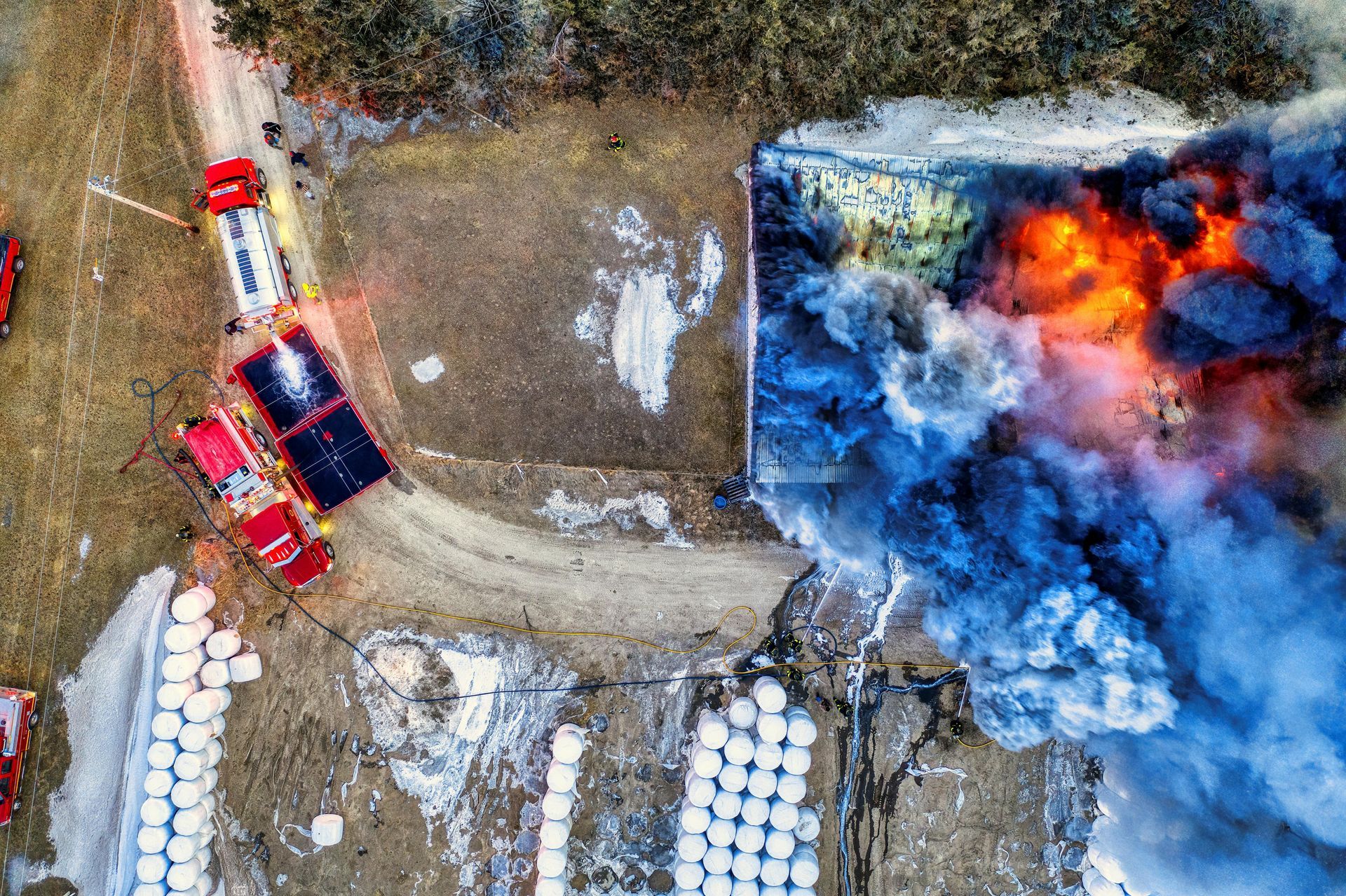
Forensic Investigations
Aerial Evidence That Holds Up Under Cross-Examination.
Fire scenes, fatality investigations, property disputes, and complex civil matters all share one thing: a narrow window to document the truth before demolition crews, weather, or repairs erase it. Once that record is gone, no investigator and no expert can reconstruct it from a clipboard and a tape measure.
The Problem
What you're up against
Fire scenes, fatality investigations, property disputes, and complex civil matters all share one thing: a narrow window to document the truth before demolition crews, weather, or repairs erase it. Once that record is gone, no investigator and no expert can reconstruct it from a clipboard and a tape measure.
What's at Stake
The cost of waiting
Origin-and-cause findings get challenged. Chain-of-custody gaps get exhibits excluded. Cases that should have been won at summary judgment drag into trial, or settle for a fraction of their value, because the photographic record was incomplete, undated, or impossible to authenticate. Opposing counsel doesn't need to prove you wrong — they only need to make a jury wonder.
How We Solve It
Our approach
We deploy with a single purpose: produce evidence that is admissible, defensible, and persuasive. Methodical flight patterns, redundant capture, SHA-256 hashing at the source, a signed pilot affidavit, and deposition availability on request. Every file is documented from the moment it leaves the aircraft to the moment your expert opens it.
What You Receive
Every engagement, packaged for legal review
Defensible, organized, and easy to hand to a paralegal, expert, or court.
Frequently Asked
Forensic Drone Investigations — FAQ
Is your work admissible as evidence?
+
Yes. Every flight produces hashed originals, a timestamped flight log, GPS metadata, pilot Part 107 credentials, and a signed affidavit of authenticity. Our pilot is available as a fact witness for deposition or trial.
How do you handle chain of custody?
+
Originals are SHA-256 hashed at the point of capture, transferred to write-protected storage, and never altered. You receive the unedited originals, any annotated working copies, and a complete chain-of-custody manifest.
Can you coordinate with law enforcement, fire investigators, or SIU?
+
Yes. We routinely work alongside FHP, sheriff's offices, fire marshals, ATF investigators, and SIU teams. We stage outside the active perimeter and request access through the on-scene supervisor with COI in hand.
Do you carry insurance, and can you name our firm as additional insured?
+
Yes. We carry $1M+ in commercial drone liability insurance and can issue a certificate of insurance naming your firm or client as additional insured before the flight.
Can you fly in controlled airspace or at night?
+
Yes. We hold the necessary FAA waivers for night operations and routinely coordinate LAANC approvals for airspace around Pensacola NAS, Eglin AFB, Hurlburt Field, Duke Field, and the Panhandle's commercial airports.
Will the pilot testify if needed?
+
Yes. Our pilot is available for deposition and trial as a fact witness regarding the flight, equipment, capture process, and chain of custody.
Request Documentation
Request forensic drone investigations
Tell us what happened, where, and your deadline. We'll confirm scope, ETA, and pricing — usually within minutes during business hours.
Don't Lose The Scene
Need forensic drone investigations now?
Rapid-response, court-ready coverage across the Florida Panhandle. Available 7 days a week.