Veteran-Owned · FAA Part 107 · Commercially Insured · Rapid Response
850-803-7663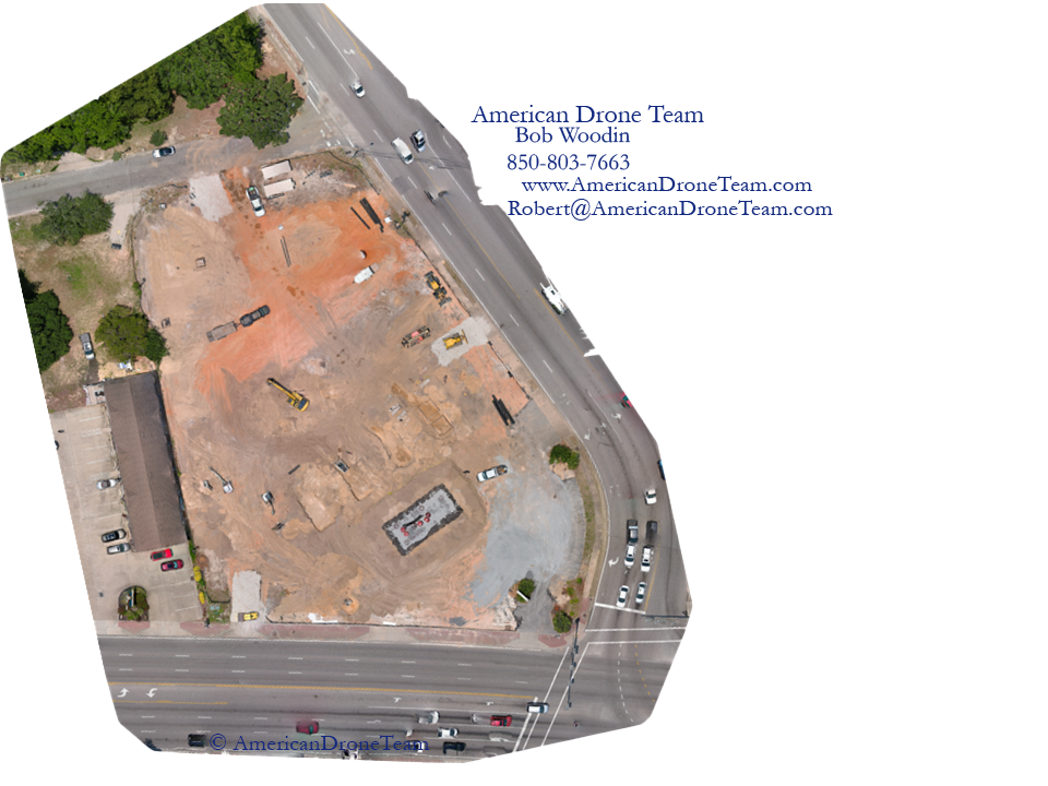
Mapping & 3D Modeling
Measurable, Geo-Accurate Maps of the Site in Question.
Decade-old surveys, ambiguous plats, encroachment claims, and acreage disputes leave attorneys, engineers, and property owners arguing about a site that nobody has actually measured in years. Ground-level photos can't answer the question, and a fresh ground survey can take weeks.
The Problem
What you're up against
Decade-old surveys, ambiguous plats, encroachment claims, and acreage disputes leave attorneys, engineers, and property owners arguing about a site that nobody has actually measured in years. Ground-level photos can't answer the question, and a fresh ground survey can take weeks.
What's at Stake
The cost of waiting
Litigation drags. Settlements collapse over a few feet of disagreement. Construction restarts get delayed waiting on a measurable record. When the only exhibit on the table is an outdated drawing, both sides' experts end up arguing about the map instead of the merits of the case.
How We Solve It
Our approach
We produce survey-grade orthomosaics, elevation models, and 3D reconstructions in days, not weeks. Every pixel is geo-referenced, every distance is measurable to documented accuracy, and every output is built to be cited in expert reports, used as a courtroom exhibit, and verified against hashed source imagery.
What You Receive
Every engagement, packaged for legal review
Defensible, organized, and easy to hand to a paralegal, expert, or court.
Frequently Asked
Orthomosaic Mapping & 3D Modeling — FAQ
How accurate are your maps and measurements?
+
Standard photogrammetric accuracy is 2–5 cm horizontal / 5–10 cm vertical. With ground control points (GCPs), we deliver survey-grade results suitable for engineering and legal reference. Accuracy is documented in every deliverable.
What file formats do we receive?
+
GeoTIFF orthomosaics, DSM/DTM rasters, OBJ/FBX 3D models, LAS point clouds, and annotated PDF maps with scale and legend. Source RAW imagery and the full flight log are included for verification.
Can the maps be used in court or expert reports?
+
Yes. Maps are geo-referenced, measurable, and accompanied by flight logs, hashed source imagery, pilot credentials, and an affidavit. They're built to be cited in expert reports and used as exhibits.
How long does a mapping project take?
+
Most sites are flown in a single visit and processed within 3–5 business days. Rush processing is available. Complex multi-day captures (large parcels, repeat flights, GCP setups) are scoped in advance.
Do you handle airspace clearances?
+
Yes. We file LAANC authorizations for controlled airspace around Pensacola NAS, Eglin AFB, Hurlburt Field, Duke Field, and the Panhandle's commercial airports. Plan ahead — some authorizations require lead time.
Can you fly the same site multiple times for comparison?
+
Yes. Repeat flights with consistent parameters produce time-series data — ideal for construction progress, pre/post-storm comparisons, erosion monitoring, and litigation timelines.
Request Documentation
Request orthomosaic mapping & 3d modeling
Tell us what happened, where, and your deadline. We'll confirm scope, ETA, and pricing — usually within minutes during business hours.
Don't Lose The Scene
Need orthomosaic mapping & 3d modeling now?
Rapid-response, court-ready coverage across the Florida Panhandle. Available 7 days a week.